Earth Camp Wyoming – Day 6

Our last day in Wyoming. The group has experienced so much – it has been a fantastic educational adventure. Today we split up into two hiking groups. The whole group started hiking from Jenny Lake with 3 volunteers from the Geologists of Jackson Hole (we were in good hands as two are volunteer backcountry rangers). Our first encounter was with a black bear and her cub – that got our attention!

After this, one group headed up to Inspiration Point and the other decided to tackle the 15.3 mile (roundtrip) hike to Lake Solitude – rated a 20.0 (strenuous) on the difficulty scale with a 2350 foot elevation gain, up to a glacial lake at 9048 feet! I’m not sure any of the students in the group thought they could accomplish this feat when Earth Camp started, but 10 of our 18 Earth Campers started and finished the hike! I was so incredibly impressed!!! The Lake Solitude Hike is rated one of the hardest in the park (and just was given the distinction as one of the top 10 most beautiful day hikes in the world)

It was an inspiring way to end the week for all of our students and staff. Thanks for a great Earth Camp Wyoming experience!

Earth Camp Wyoming – Day 5

Today we explored Grand Teton National Park. It was a day learning about the power of nature. The morning was spent at the Gros Ventre Slide of 1925 and in the afternoon we attempted to hike to Phelps Lake. Here we learned that a 20% chance of rain in the Tetons really means a 99% chance of a hailstorm in the mountains (we hunkered down under the pine trees)!


Earth Camp Wyoming – Day 4

Today we were up EARLY! Earth campers had the choice of sleeping in until 8am, or getting up at 4:45 am to go look for wolves. Everyone voted “Wolves”! and we were not disappointed. We met up with NPS biologist Rick McIntyre at Hayden Valley and got to see the pack, including pups rolling around and playing. Rick captivated the group with stories of Yellowstone’s wolves for over an hour – many students (and instructors!) had tears rolling down their faces during many of his stories. It was a great way to start off the morning.

After this, the group split up – one group headed to the Grand Canyon of Yellowstone and the other hiked up Mt. Washburn. We all left Yellowstone in the evening to get back to the Tetons for the rest of Earth Camp.

Earth Camp with NPS Wolf Biologist, Rick McIntyre

At the top of Mt. Washburn!

Earth Camp Wyoming – Day 3

Today we spent  more time exploring Yellowstone National Park. Stops included: Norris Geyser Basin, Obsidian Cliffs, a hike up Bunsen Peak, and Mammoth Hot Springs.

At the top of Bunsen Peak – 8,564 ft. elevation

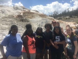
Mammoth Hot Springs


Earth Camp Wyoming – Day 2

Yellowstone!

The group left Jackson, WY for 2 days up north in Yellowstone National Park. First stop was Old Faithful – then several short walks around the various geyser basins.

The group observed the four different hydrothermal features and learned about how each one formed and why they look the way they do. (geysers, hot springs, fumaroles, and mud pots)

Old Faithful erupting behind the Earth Campers!


A visit to Grand Prismatic Hot Spring


Earth Camp Wyoming – Day 1

How exciting to have all the Earth Campers out in The University of Michigan’s Earth and Environmental Science Department’s “home away from home” – Jackson, WY. They arrived last night to one of the most beautiful airports in the world and headed out for a day at our Camp Davis Field Station.

First part of the day was to introduce them to hiking with a trip up Mt. Ann for a geology lesson on the Hoback Normal Fault. The hike was steep in places and about 2 miles each way – it was a good “wake-up” for everyone to get used to the elevation, and in some cases, exposed to hiking for the first time ever. Everyone made it up – a great accomplishment for day one of Earth Camp!

They were rewarded with great views of the Teton Mountains and the Hoback Normal Fault. We were lucky to be accompanied by John Hebberger Jr. – a (very knowledgeable) member of the Geologists of Jackson Hole. He spent the hike up talking with the students and gave a great presentation at the top.

After Mt. Anne, we spent the rest of the day at Camp Davis launching a weather balloon, getting an introduction to Yellowstone and bear safety, as well as mingling with Michigan undergraduates and professors. The kitchen staff put on an outdoor cook-out for us before we headed back to Jackson, WY to prepare for our early departure for Yellowstone National Park.

Earth Camp students at the top of Mt. Anne

Jordan on top of Mt. Anne – the Hoback Normal Fault is visible along the red line in the background

Earth Camp students playing hacky sack with the Camp Davis profs and undergrads


Earth Camp 2016 – Inaugural Weather Balloon Launch (Ann Arbor)

We recently launched our new high-altitude weather balloon with our incoming class of Earth Camp students who spent one week this summer on campus and at Sleeping Bear Dunes. The high-altitude weather balloon was part of an NSF grant awarded to Chris Poulsen and his postdoc Chris Skinner to be used during our outreach activities.

The high-altitude weather balloon system consists of a latex helium balloon, a parachute, a payload box for experiments and cameras, a waterproof SPOT tracking device, and a control module that provides real-time altitude, temperature, humidity, vertical velocity, horizontal velocity, spin rate, turbulence, pressure, heading, GPS coordinates, and battery life data. Our modified version also included our mascot – the stuffed animal Michigan Bear. The system rises up to approximately 100,000 feet until the latex balloon bursts, at which point the parachute opens up when it starts falling to the ground.

Chris S. started checking the weather and plotting launch and landing sites a week out and picked Sunday, August 7th as our launch date. The plan was to launch near Lansing, MI so the balloon would land just north of Ann Arbor in Brighton, MI.
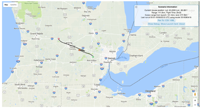
Figure 1a

Figure 1: projected flight path – the red dot is the burst site

The skies were clear, there was very little surface wind, and the Earth Camp students were excited. Everything was perfect for a launch, except the jet stream was rip-roaring strong. This means a longer horizontal travel distance for the balloon, hence the long drive to Lansing to launch it. The day before our launch, as we were going through our preparations, Chris’s main concern seemed to be the screaming fast Jet Stream.

“Jenna, just make sure we don’t underfill the balloon with helium”

“We just have to make sure we fill it with the right amount of helium, or even go over a bit”

“If we underfill with helium, the balloon will rise too slowly and get stuck in the jet stream – it will end up in the lake.”

“It’s better to overfill, rather than underfill the balloon with helium”

Launch day arrived, and I promptly proceeded to (under)fill the balloon with helium. The students released it, we watched it rise, and Chris turned to me and said “it’s rising a lot slower than I thought it would.”
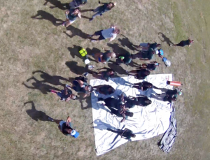
Figure 1

Figure 2: photo taken from the weather balloon of the students watching the launch

We hopped in our vans (which in high-altitude ballooning lingo are now called “Chase Vehicles”) and started driving towards Brighton for recovery. Chris was tracking the balloon real time and it was rising and heading in the right direction – we were just way ahead of it. We got to the targeted landing site and compared our real-time data to previous high-altitude balloon launches – our balloon was rising at ¼ of the minimum rate it was supposed to be due to the low helium amount – this was going to be a long day. The students headed off to their next activity and Chris and I holed up in our makeshift control room. Michigan Bear was on a wild, international, adventure and we were determined to get him back (along with thousands of dollars of electronic equipment).
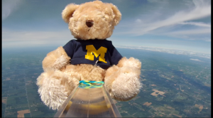
Figure 3

Figure 3: Michigan Bear in space

Our predictions of the balloon’s landing site were varying wildly – first we thought it might end up all the way in Pennsylvania, then we thought Columbus, OH, then we were sure it was going to be the middle of Lake Erie. Eventually, Point Pelee National Park – a small peninsula in Canada jutting into Lake Erie – was determined to be the likely landing point. Then we lost contact with our emergency SPOT beacon at 70,000 feet, and the battery pack on the control module died and we lost our real-time GPS tracking. Our balloon was being carried with the jet stream and we had no idea where it was.

We contacted Point Pelee and they immediately had a high-interest of followers/commenters on their Facebook page after they posted this:
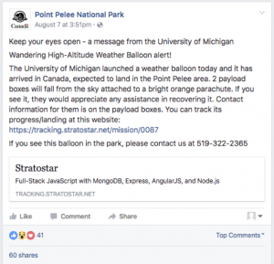
Figure 4

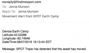
Our battery pack was dead, so our GPS was not going to turn back on, but after numerous google searches, we were hopeful the SPOT emergency beacon device would turn back on when it got to a lower elevation. I’m pretty sure this is the closest feeling I will ever have to sitting in a NASA control room waiting for my rover to land on Mars. Chris S. was pacing, I was clicking refresh on our SPOT page every 5 seconds – then the alert arrived: “SPOT Trace has detected that the asset has moved.

Figure 5

We checked the map – it looked like our system had landed right on the beach. We zoomed in, and OH NO!, it landed 50 yards off the beach in Lake Erie. We watched the SPOT updates track it as it slowly moved with the longshore current.

Figure 6

I decided to do what any self-respecting Minnesotan would and I called a fisherman from the port near where it landed. He seemed fairly skeptical of my account:

um, hi. I am calling from Michigan and we launched a balloon up into space and it just fell back to Earth with a bright orange parachute and landed right offshore from your fishing charter location. I can see it on Google Maps and it right offshore of the huge mansion with the jetties in front of it”.

He sounded amused and told me to call back in 15 minutes. I did, and now he sounded excited. He had called a friend who lived on the bluff and could see the parachute and the payload boxes floating in the water. Chris drove over to Canada, met Jon of Chante Charters who had gone out in his boat to recover the system, and brought everything home.

The next day the students got to see the photos taken from the onboard cameras, as well as analyze the launch data. They were completely engrossed, thought the story of the international journey was really cool, and were posting about the launch on all their social media accounts. An all-around success! The students learned that in science, things rarely turn out like you expect, but you learn from your mistakes and keep moving on. We got great data, amazing pictures, learned a lot about the atmosphere, and most importantly, the students were excited about the whole outdoor, hands-on, scientific experience.

If you want to look at our launch data, you can find everything here: https://tracking.stratostar.net/mission/0087
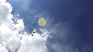
 

Figure 7
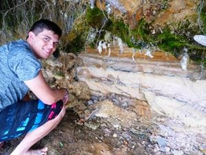
Earth Camp 2016 – Day 5 (Houghton, MI)

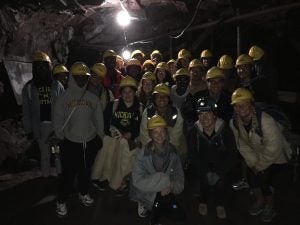
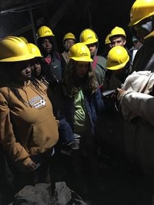
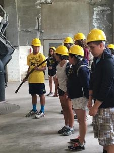
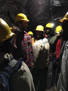
Today the campers went to Houghton, MI for a tour of the Quincey Copper Mine and to explore the A.E. Seaman Mineral Museum where the University of Michigan mineral collection is displayed.

While in the Marquette region, the students went to Jasper Knob to see banded iron formations – the backbone of the iron industry in Michigan. Today they saw and learned about the copper industry, another important piece of Michigan’s economic geology and one closely linked to our department. Michigan State Geologist, Douglass Houton, reported on the copper deposits in 1841 and later became the first professor the the Geology Department at The University of Michigan.

IMG_0254

IMG_0252 IMG_0255

IMG_0257


Earth Camp 2016 – Day 4 (Marquette, MI)

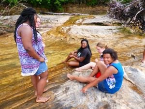
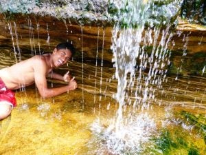
Today we moved on from the perfectly horizontal, sedimentary rock layers of Pictured Rocks National Lakeshore to the crazy, amazing, rocks a bit west near Marquette.

We started at a road cut where Forrest showed us a dolomite and schist, separated by a fault. We also walked around this area and found stromatolite fossils – stromatolites are layered mounds, columns, and sheet-like sedimentary rocks. They were originally formed by the growth of layer upon layer of cyanobacteria, a single-celled photosynthesizing microbe.

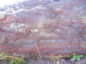
Our next stop was the banded iron formation at Jasper Knob – the hands-down favorite rock of most instructors here. The students learned about the Great Oxidation Event responsible for forming these rocks approximately 2 billion years ago!

Next stop, Presque Isle Park in Marquette to view the Jacobsville Sandstone, the “Great” unconformity between the serpentinized peridotite and the Jacobsville Sandstone, as well as search for sulfide minerals at Black Rocks cliffs.

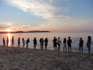
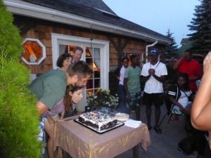
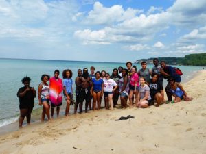
We ended the day with sunset rock-skipping on the beach, and dinner and cake celebrating Forrest’s birthday at his house nearby.

Off to Houghton, MI tomorrow to look for copper!

Sunset rock skipping

Sunset rock skipping

Happy birthday Forrest!

Happy birthday Forrest!

Jacobsville Sandstone

Jacobsville Sandstone

The "Great" unconformity

Jasper Knob BIF lesson

Jasper Knob BIF lesson

Banded Iron Formation

Banded Iron Formation

Road-cut geology lesson

Road-cut geology lesson

Banded Iron Formation

Banded Iron Formation