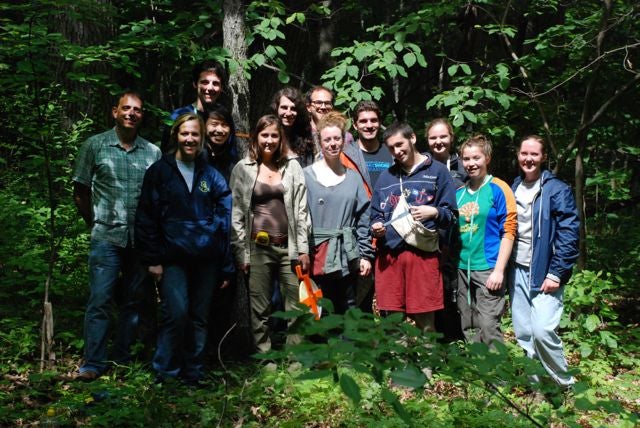
Front row: Leah Spalding, Jasmine Gramling, Hillary Butterworth, Isaac Levine, Jayna Sames, Rachael Lacey
(Katie Parks not shown; photo by Dale Austin)
July 23, 2014 – As a post-doctoral fellow at the Smithsonian Tropical Institute (STRI), I worked in forest inventory plots in Panama, French Guiana, and Ecuador. Large scale forest plots are invaluable for sampling woody plant populations and associated biota. The 50 ha plot on Barro Colorado Island (BCI) Panama, for example, is not only one of the most intensively studied tropical forests in the world, but its soils, microbes, animals and herbs have also been intensively studied in part because of the infrastructure the plot provides.
The E.S. George Reserve (ESGR) has its own large scale forest inventory plot, which was established in 2003 for studies of forest dynamics by Profs John Vandermeer (EEB) and Ivette Perfecto (SNRE). It started as an 11 ha plot and was expanded to 23 ha in 2008. The plot is situated in mature oak-hickory forest and includes all trees ≥10 cm circumference (~ 3 cm diameter at breast height [dbh]). As part of the third census of tree growth, and as the start of a major initiative of the ESGR, the “perfectameer” plot will be joining the Smithsonian Institute’s Forest Global Earth Observatory (ForestGEO) network through collaboration with the Smithsonian Institution.
CTFS forest plots are surveyed at approximately 5 year intervals to quantify tree growth, mortality, and recruitment into the lower size class. Although these plots were started as a way to study species-rich tropical forests, CTFS methods have been adopted by temperate forest researchers, first in China, then later in Europe and the US. The CTFS-ForestGEO network presently includes 53 plots located in 23 countries, with an estimated 4.5 million trees from 8,500 species. The data they provide on forest dynamics are vital for research on biotic impacts and feedbacks of global climate change.
To learn the Smithsonian protocols, CTFS flew EEB alumni David Allen to Panama to visit the BCI plot and learn the field methods and database protocols. Dave is highly familiar with the ESGR forests, having done his PhD dissertation work in the plot, supervised by Prof Vandermeer. Dave, who now teaches at Middlebury College in Vermont, was willing to spend a couple of months this summer with Middlebury and UM students to resurvey the ESGR plot.
This has not been a small task — the 23 ha plot is the size of 43 American football fields! Dave is working with an enthusiastic group of 12 students, (see photo), who have endured rain, mosquitos, biting horseflies and clonal witch hazels to tag, map and measure all woody stems ≥1 cm dbh stem. They expect to finish their work in early August.
With a Smithsonian plot in Michigan, UM students will be able to compare the dynamics of the ESGR plot with oak-hickory forests in Indiana or maple-dominated forests in China. The possibilities are endless. The precise mapping will also provide a spatial framework for studies of insects, fungi, soils, and other aspects of the forest biota.
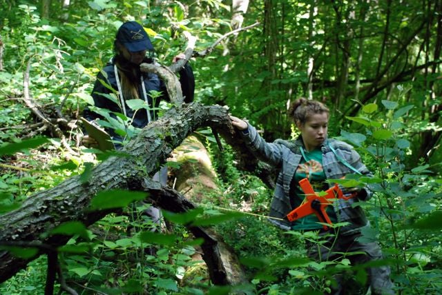
Mapping tree coordinates in the ESGR plot (photo by Dale Austin)
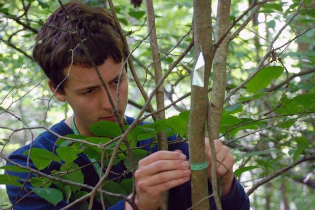
Measuring a newly tagged witch-hazel (photo by Dale Austin)
One thought to “A CTFS forest plot in Michigan”
Comments are closed.