
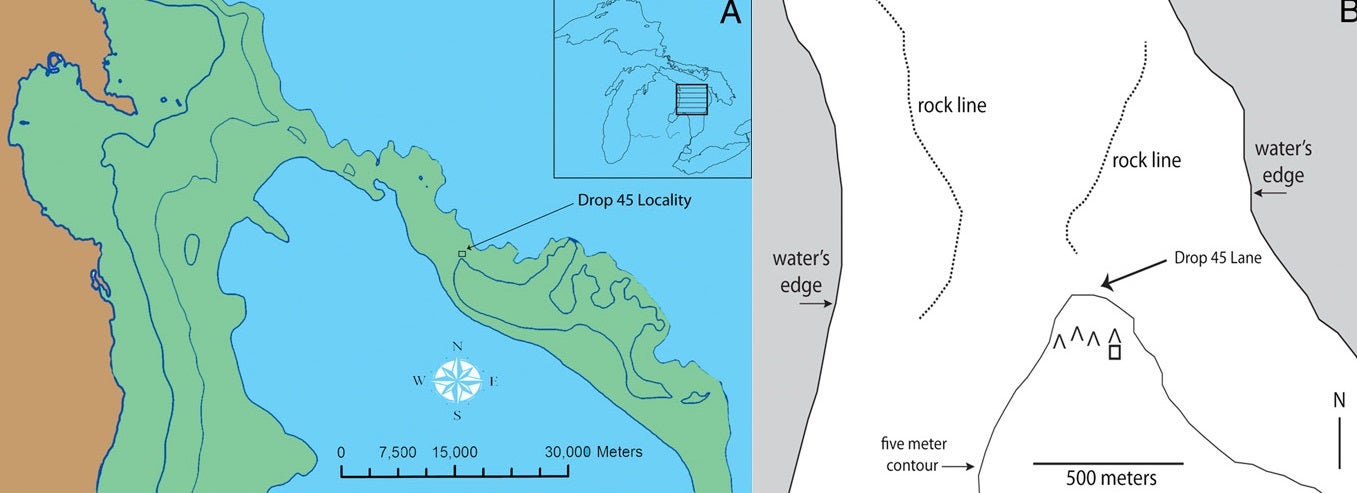
The Drop 45 Drive Lane is the most complex hunting structure identified to date in the Great Lakes region. It is located in 37 m of water, 56 km southeast of Alpena, MI. This locality, comprising only 8 ha, has an unusually high density of confirmed hunting features, including at least four V-shaped hunting blinds and a rectangular construction that, following ethnographic parallels, may represent a meat cache.
The feature is constructed on level limestone bedrock and is comprised of two parallel lines of stones leading toward an effective cul-de-sac formed by the natural cobble pavement. The stone lane is 8 m wide and 30 m long. The drive lane has three associated circular hunting blinds that are built into the stone lines and a series of perpendicular flanking lines on its west side. The interior of the drive lane is devoid of rocks and covered with clean sand to a depth of approximately 6 cm overlaying the limestone bedrock.
Systematic sampling along the length of the lane yielded over a dozen chipped stone flakes. These flakes exhibited sharp edges, and elements of standard flake morphology and cultural manufacture such as platforms, bulbs of percussion, and crushing. Seven flakes were located in the southern opening of the drive lane, and two each were found in two of the associated hunting blinds.
The Drop 45 Drive Lane. (A) A plan showing the major topographic and cultural features associated with the drive lane. Black dots represent the location of placed stones. The hunting blinds incorporated within the main drive lane feature are labeled. The raised cobble surface to the north and west of the drive lane varies from 1 to 2 m higher than the bedrock on which the drive lane stones are located. This plan was produced as an overlay of the acoustic image.
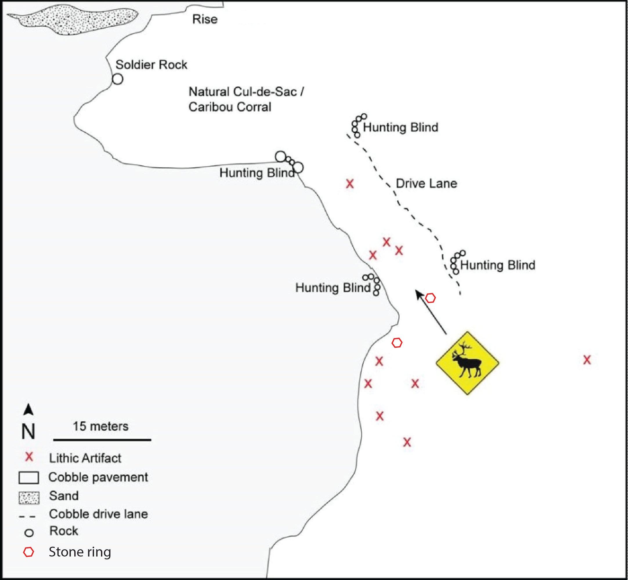
(B) An acoustic image of the drive lane produced via a mosaic of scanning sonar images. The scanning unit is the black circular area near the center of the image, and the red circles surrounding have radii that increase by 15 m. A trace of the second scanning sonar location is visible in the southeast of the image. Light colored objects are stones that produce a strong acoustic signature, whereas dark areas are acoustic shadows.
