ESGR GIS coverage
Developed by Timothy G. Howard
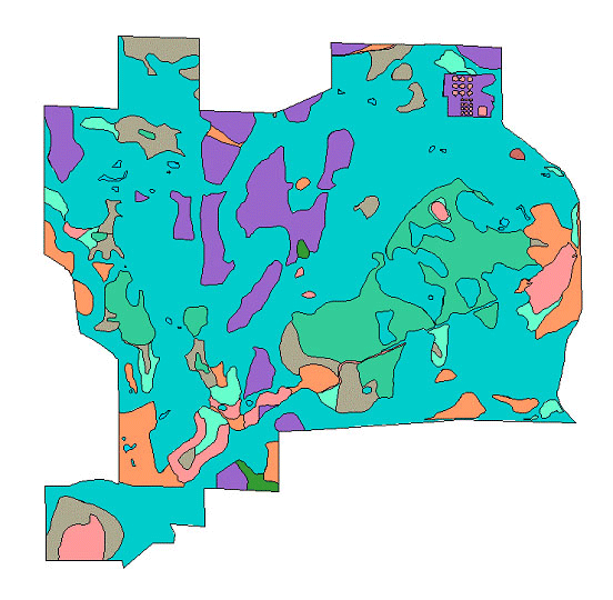
The link below downloads a Zip file of GIS coverages created in ArcInfo by Tim Howard in 1998. When unzipped, a text file called “covercodes.txt” contains the vegetation cover type that corresponds to the cover type number in the covtype4 coverage.
Metadata
Five foot contour lines digitized from the 1933 map created by engineer John Ruskin. Ten foot contours are digitized from the Pinckney and Gregory Quadrangle 7.5 minute series by the U. S. Geological Survey. Roads and cover types are based on aerial photos taken in 1991 and confirmed on the ground. Boundary and fenceline are digitized from surveys completed by Atwell-Hicks, Inc. for the University of Michigan and by the UM Engineering Services (1986-1990).