

By Sebastián Encina, Collections Manager
Recently, the University of Michigan announced it had made an offer to purchase the property currently owned and operated by the Fingerle Lumber Company. This expansion will increase U-M’s Ann Arbor land holdings by 6.54 acres. At this time, the university has not announced what it plans to do with the property.
Over the years, U-M’s presence in Ann Arbor has expanded well beyond central campus. As the needs of the university and its students, staff, and faculty continue to expand, so too does the need for space. The Bentley Historical Library owns original maps of the university showing a very modest beginning, with a few buildings on what is now central campus, including the President’s House and a few other structures.
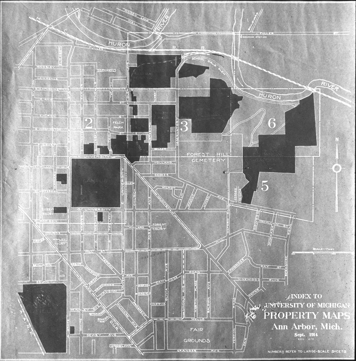
For this month’s “From the Archives,” we present this gem showing the U-M campus from 1914: the Index to University of Michigan Property Maps. The map highlights U-M property in the darker blocks, from which we can see locations we recognize from U-M campus now in 2019. We see central campus, or just “Campus.” Other blocks are also named, such as the Botanical Gardens, General Hospital, Ferry Field, and Palmer Field.
Though not named, we can also see a small block across from Campus, between State Street and Maynard, the future home of the Kelsey Museum. At this point, the property was not yet a museum.
Around this same time, in 1914, Francis Kelsey hired a photographer named George R. Swain to photograph archaeological sites and artifacts in Europe and North Africa. Swain remained with the university until his death in 1947. After his visits to places such as Karanis, Carthage, and Pisidian Antioch, Swain dedicated his time at the university working for the Library, making copy prints and slides for use by professors and students. This glass slide was likely produced by Swain well after 1914. The reason is unknown; perhaps it was presented as an interesting find from the archives, much the same way we present it today.
Over 100 years after this map was created, the campus of U-M is vastly different, and it continues to change with each passing year. By 2114, a map of campus will undoubtedly look even more foreign to us. Students and archivists looking back on our current maps will see spots familiar to them, but still so foreign. Even a map produced today would would look very different from one produced in just a few months, given the news of Fingerle.
The archives provide for us a snapshot at a certain time period in both the Kelsey’s history as well as that of the university. Though constantly changing, we can see the progression of both, and how nothing remains static. In 100 years, a future Kelsey archivist may present this same image in the same manner we do now, showcasing the humble beginnings of the university and how much progress has been made since.