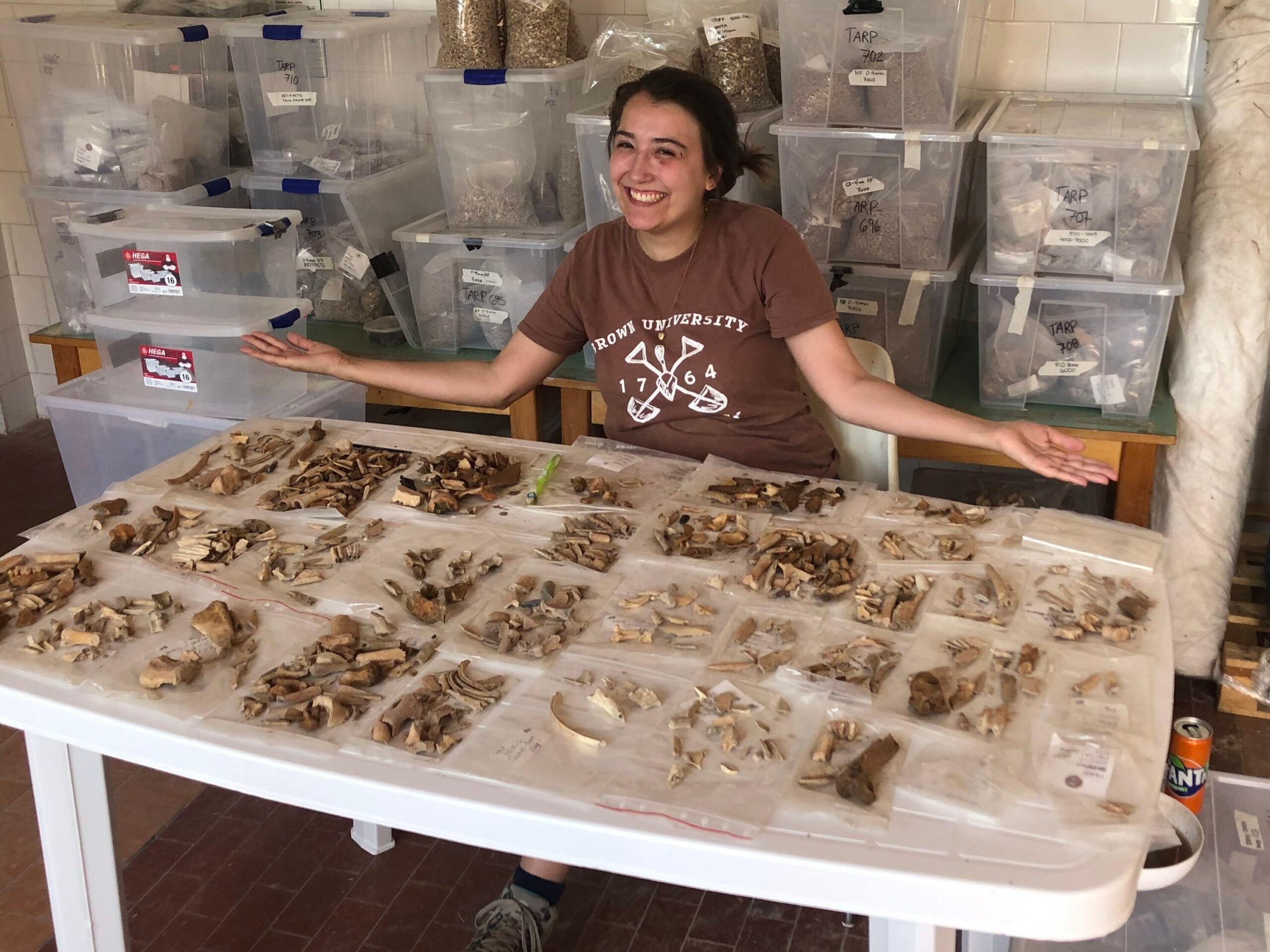
A bone bonanza! Bailey with faunal finds from the Tharros Archaeological Project.
I spent the month of June in Sardinia, Italy, at the Tharros Archaeological Project run by the University of Cincinnati. Tharros was a Punic and Roman city inhabited from the 8th century BCE to the 4th century CE.
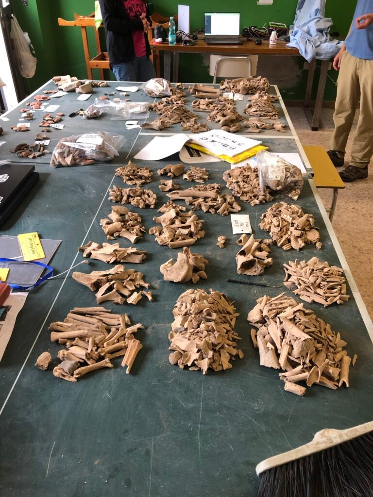
I spent most of my time at Tharros in our finds lab in the nearby town of Cabras. I was responsible for washing, processing, and recording all of the project’s faunal material for the first time since it began in 2019. Our goal for the season was to begin to understand some of the patterns of animal use visible in the excavated material and to identify which contexts were worth coming back to for a closer look in later years.
This year, the field team excavated an 18-meter trench within a Roman house from the 3rd century CE, as well as two trenches in the temple area of Tharros. I enjoyed working with colleagues from Cincinnati, Stanford University, and Brown University. Finding equid and deer bones in areas all over Tharros was very exciting, but my favorite finds were hedgehog mandibles.
I could not have accomplished any of the work I’ve done at Tharros or elsewhere without the support of the Kelsey Museum and, in particular, Dr. Richard Redding, whom I miss very much.
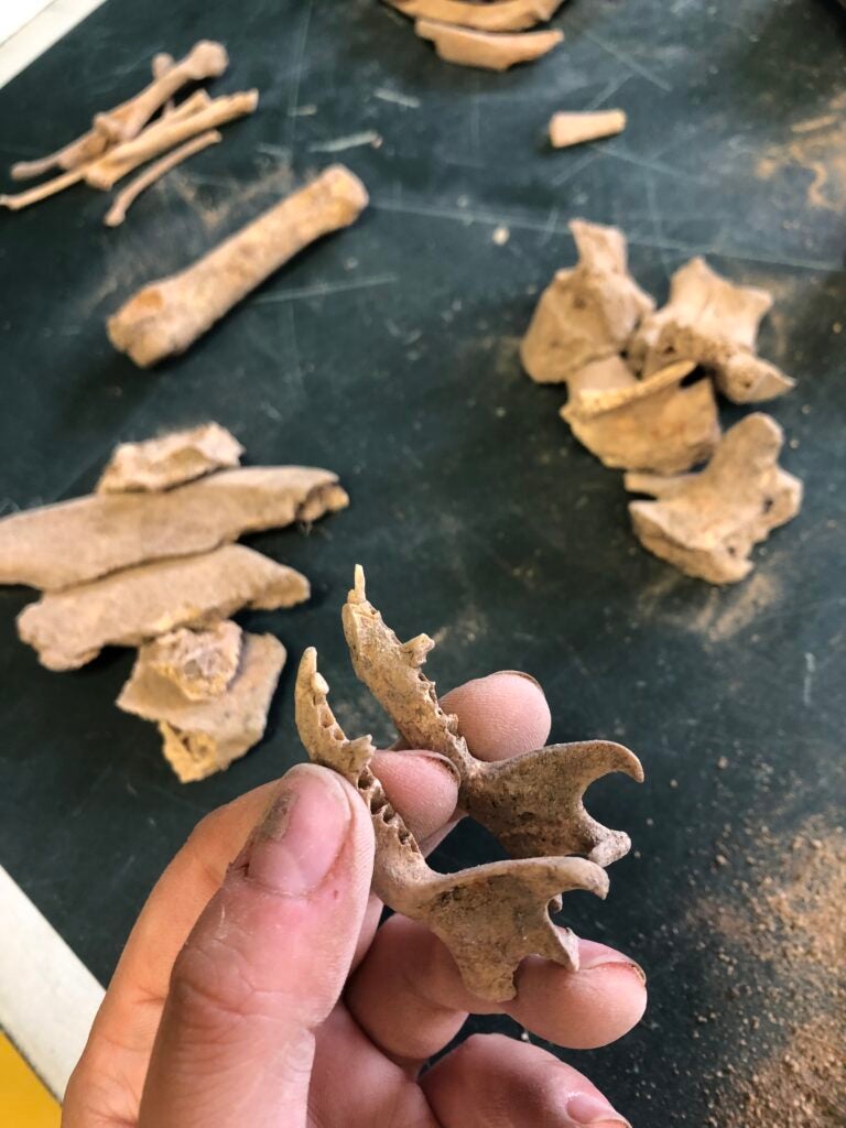
One of the hedgehog mandibles excavated at Tharros.Processing the Tharros finds.
Hello, friends of the Kelsey Blog! The past six months have really flown by, haven’t they? Suzanne and I have spent quite a bit of this time traveling for work, something that we both missed during the pandemic. Here are some highlights!
In September and October, Suzanne and I returned to Abydos, Egypt, where we provide conservation for the Abydos Middle Cemetery (AMC) Project. We worked on a variety of things, including objects from the serdab of Weni the Elder, as well as newly excavated artifacts, alongside our Egyptian conservator colleagues Hamada Sadek and Ahmed Abdullah. Being back there—and being a part of the Weni project—was such a thrill.
AMC dig house at Abydos, Egypt
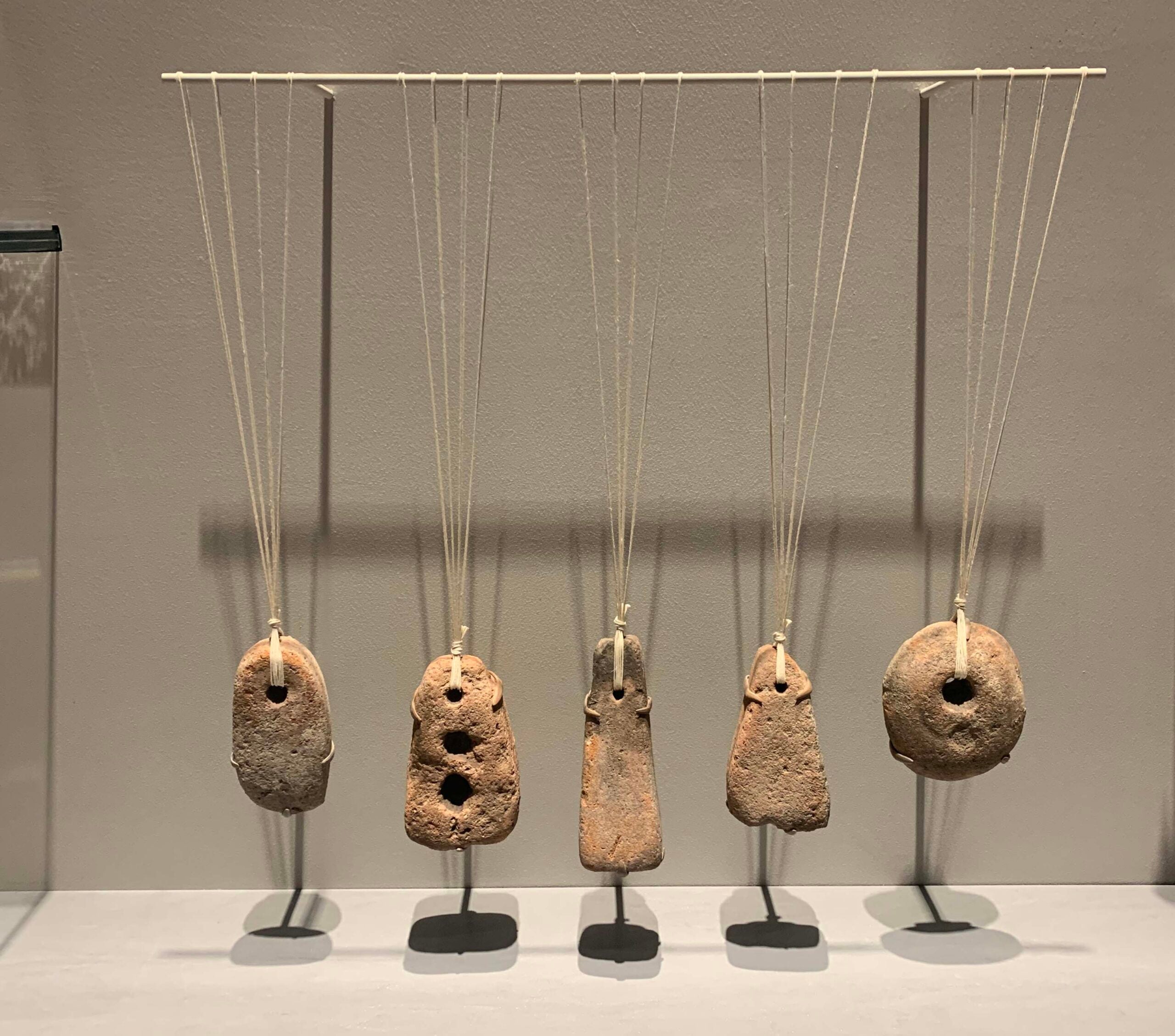
In November, Suzanne and I gave papers at the American Society of Overseas Research’s annual meeting in Boston, where Suzanne presented her research on gender equity in museums and I participated in a workshop on Roman-Egyptian funerary portraits. It was great to see colleagues in the flesh once again after many years of virtual meetings and to be able to visit some old stomping grounds, including the Museum of Fine Arts, Boston, where I took in the newly reinstalled Greek and Roman galleries. Check out this truly inspired loom weight display (I love it so much I just had to share it with you folks)! We also enjoyed a tour of the Harvard Art Museums with recent IPCAA graduate Caitlin Clerkin, who works there as a postdoctoral fellow.
Ceramic loom weights, Museum of Fine Arts, Boston; Acc. #s 84.381, 84.373, 84.374, 84.370; Greek East, 6th–4th centuries BCE, from Assos (Behramkale, Turkey)
In January, Suzanne traveled to Jebel Barkal, Sudan, where she is directing site preservation with her team of conservators and conservation architects including Elmontaser Dafalla, David Flory, and Sefian Mutwakil. Check out her blog post and more news from Barkal here.
As always, there is a lot going on in the Conservation Lab! Keep tuning in.
By Suzanne Davis, Curator of Conservation, and Carrie Roberts, Conservator
The inability to travel to the Kelsey’s field sites due to the COVID-19 pandemic has made us, well, crazy to travel to the Kelsey’s field sites. If you, too, are experiencing serious wanderlust, we invite you to take a quick photographic mini-break with us. Here’s a beautiful photo and something we love about each of the four sites we currently support.
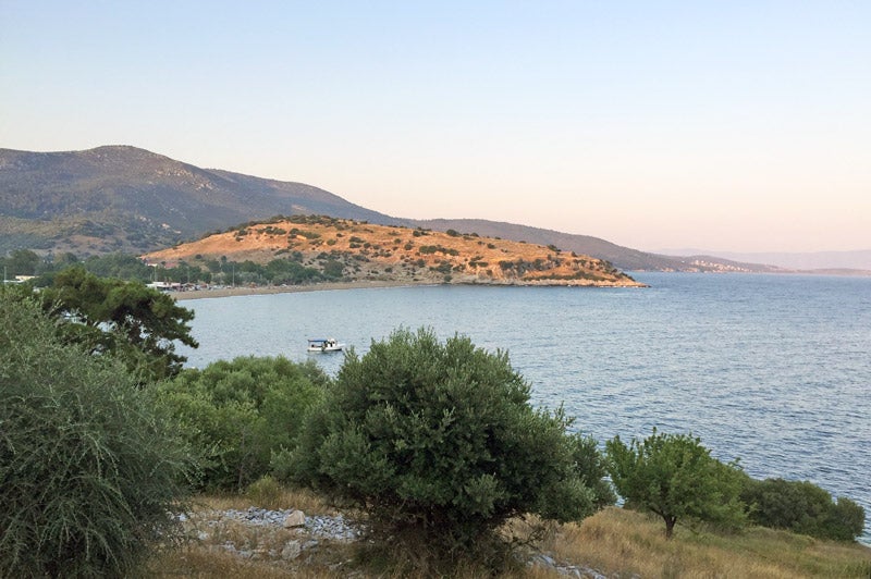
Suzanne loves the incredibly good-looking site of Notion, Turkey. It’s got everything a conservator could want — the romantic ruins of an entire ancient city, lots of conservation work to be done, and a beautiful seaside location.
Notion, Turkey. View of the site from the west at sunset; the ancient city is located on top of the yellow, sunlit hill. If you look closely, you can see the Fortifications.
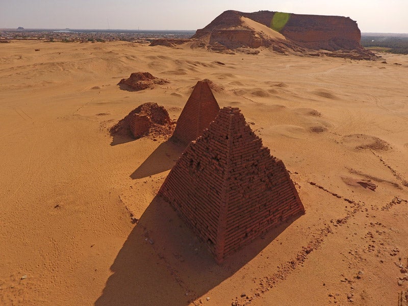
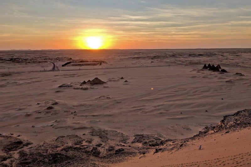
This spectacular photo of the ancient temple, cemetery, and city site of Jebel Barkal, Sudan, makes Suzanne miss the desert sunshine and all her fellow Jebel Barkal and El-Kurru teammates.
Jebel Barkal, Sudan. This image shows the remains of some of the site’s pyramids, with Jebel Barkal (in Arabic – the holy, or pure, mountain) in the background. Photo by Kate Rose.
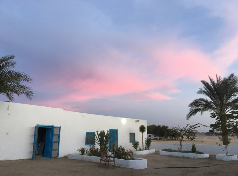
Carrie is inspired by the ancient landscape of Abydos. It’s great to drink a cup of coffee with the team at sunrise and know that the Seti I temple is only a 10-minute walk from the dig house, while the early dynastic tombs below the desert cliffs can be reached in 20 minutes.
View of the front courtyard of the Abydos dig house at sunrise.
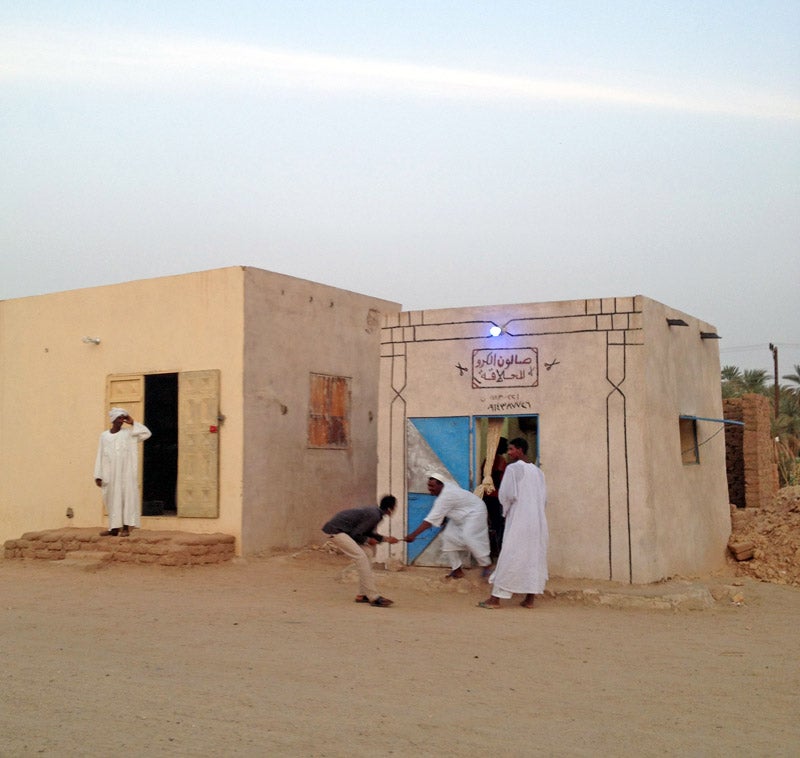
At El-Kurru, Carrie loves village life — walking from the house where we live to the temple site and saying hello and how are you to neighbors on the way, then grabbing a snack at the corner store at the end of the day. She also misses the family we live with, especially the kids.
El-Kurru, Sudan. On the left is Kurru’s hardware store, and on the right is the barbershop.
Sun setting across the desert landscape from the top of Jebel Barkal, with the pyramids in the midground.
15 February 2019
By Gregory Tucker
I was hoping to submit this last blog post on my time in Sudan, sharing some of our results, as I left the country on 21 December 2018, but unfortunately some rather significant events occurred and I had to leave the country early. On the 19th and 20th of December, protests erupted across the country with various motives that I will not focus on in this post, but I encourage you to read up about these events here and here. I was on my way to Khartoum during this period and while there I was advised to stay in the hotel and to leave the country on the earliest flight possible. In the end, I had no trouble at all leaving Sudan and saw no signs of the protests or their aftermath on the streets from the hotel to the airport, and I was very glad to arrive safely back home to news from my Sudanese friends and colleagues that they were all safe and in good health. Since I left, other research projects have continued to visit Sudan, such as the Uronarti Regional Archaeology Project, although the protests have continued off and on. These protests have recently resumed after a period of relative calm and I hope that the Michigan team now in Sudan stays safe and out of trouble!
The results of our survey work in December 2018 as part of the University of Michigan-led project!
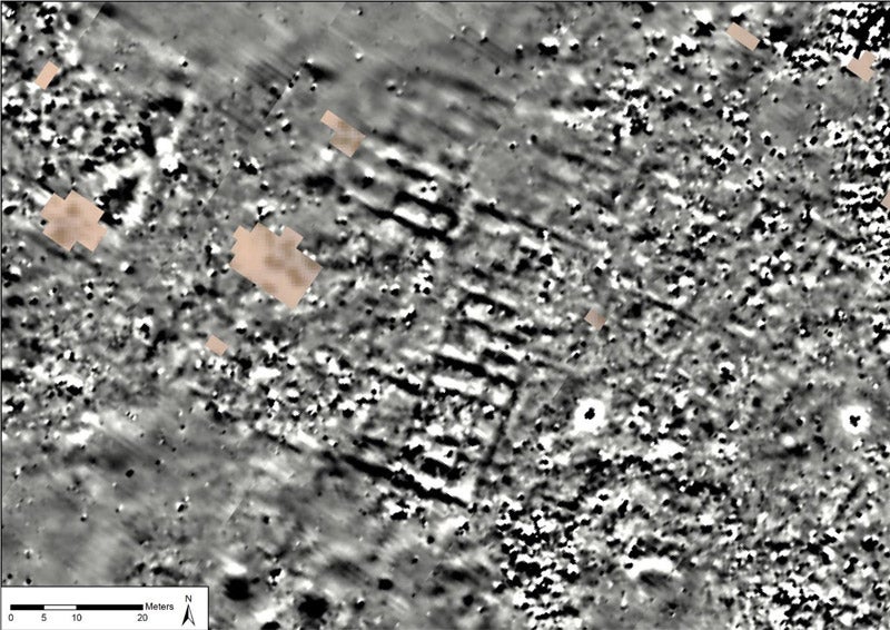
In the image above, you can see the results of this season of geophysical survey and how it relates to the large Temple of Amun, visible in the left center of the image, and to the palm line to the lower right. This season of geophysics at Jebel Barkal was successful in defining a large number of archaeological features of interest, some of which are being investigated more intensively right now by other members of the project team on site. One of these is shown in more detail in the figure below, which zooms in on the center of the larger area of gray results in the larger image. What is most significant are the straight lines and right angles formed by the lighter and darker pixels, which reflect differing magnetic readings across the surface.
Results from the center of the survey area, showing rectilinear anomalies that likely define a buried structure, not visible on the surface.
More detailed results and analysis of this survey season will be published after thorough analysis, interpretation, and comparison with the excavation results. It was a fantastic field season, even with the hot weather at the beginning and the other obstacles we encountered. At times I didn’t think that we would complete everything we set out to do, but in the end we did even more than we targeted — a rare event in my experience!
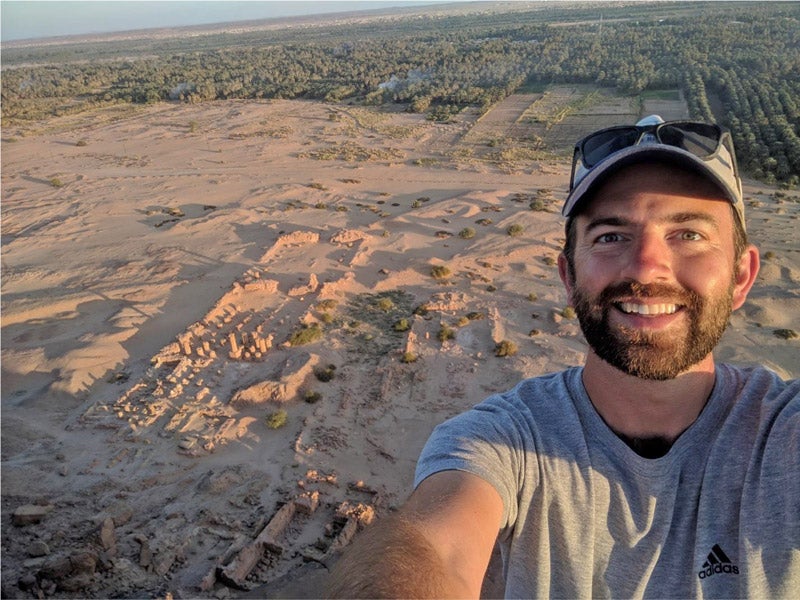
A final selfie over the site from the top of Jebel Barkal, including the Temple of Amun in the foreground and the main survey area in the near distance to the upper left of the image.
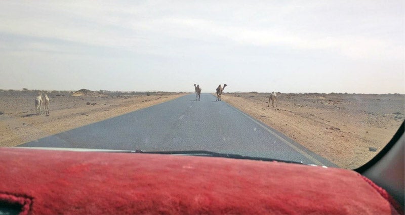
Many thanks are due to the many people who made this fieldwork possible. First of all, I want to thank my assistants in the field, Bakri Abdelmonim and Abdelbaqi Salaheddin Mohamend, who I have worked with now for many years and whose experience and expertise make my job significantly easier. Thanks also to Sami Elamin, our NCAM (National Corporation for Antiquities and Museums of Sudan) inspector, who helped me to organize work on site as well as my day-to-day life while in Sudan, and who invited me to many social events in El Kurru and nearby towns and cities, including me as much as possible in the life of the region. Many thanks to everyone in El Kurru who welcomed me during the month of fieldwork and have always welcomed me — it feels like a home away from home when I am there. I would like to also thank our project’s overall director, Geoff Emberling (University of Michigan), for supporting my work from the very start. Hopefully we’ll make many more discoveries together. Finally, the greatest of thanks are due to Larry and Julie Bernstein for the financial support that made this work possible, we could not have done it without your generosity.
Camels on the highway on the trip back to Khartoum.
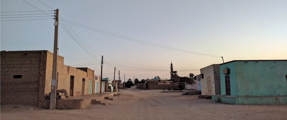
The main street in Kurru in the early morning hours before work. Waleed’s shop, where we buy snacks and supplies but most importantly bottled water, is on the left less than 100 meters from our front door, and the barber shop, painted green, is right across the street!
14 December 2018
By Gregory Tucker
The past week has been incredibly busy as we try to prepare the site for the final days of data collection before I leave for Khartoum next Thursday. In next week’s post I will share some of the initial results of all of our hard work here, but this week I will focus on what my life is like in Sudan outside of work.
The International Kurru Archaeological Project stays in the village of El Kurru, near the ancient site, and we are kindly hosted by Sadiq Mohamed Saleh and his family. This month I have been staying in Kurru rather than closer to Jebel Barkal, as it is only a 15–20 minute car ride to the site. It is also where all of my friends from past field seasons live, and where I feel welcomed as a part of the community.
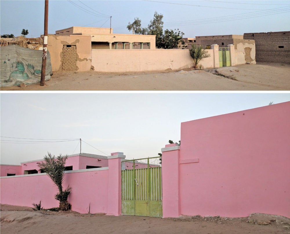
The front entrance to Sadeq’s house, before (top, 2017) and after (below, 2018) its new paint job!
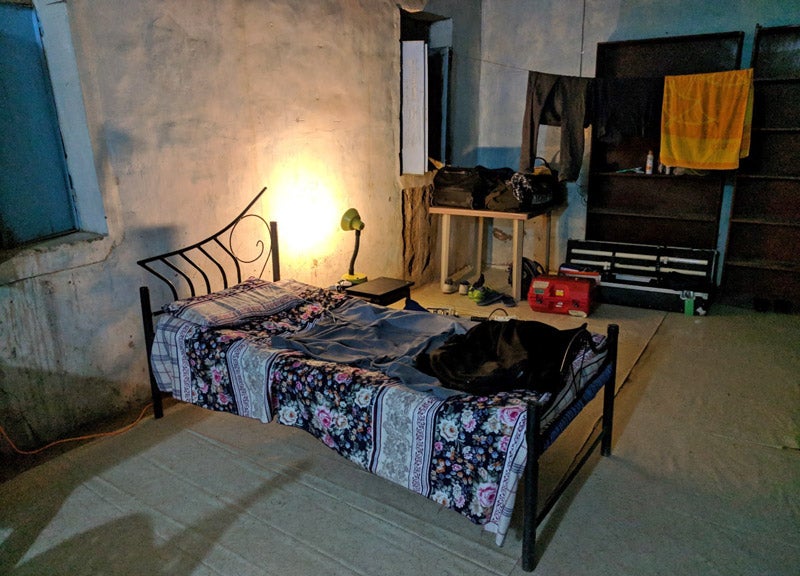
My bed (taken the first week of the project — I assure you it is nowhere near this tidy anymore) with equipment charging and my personal effects in the corner.
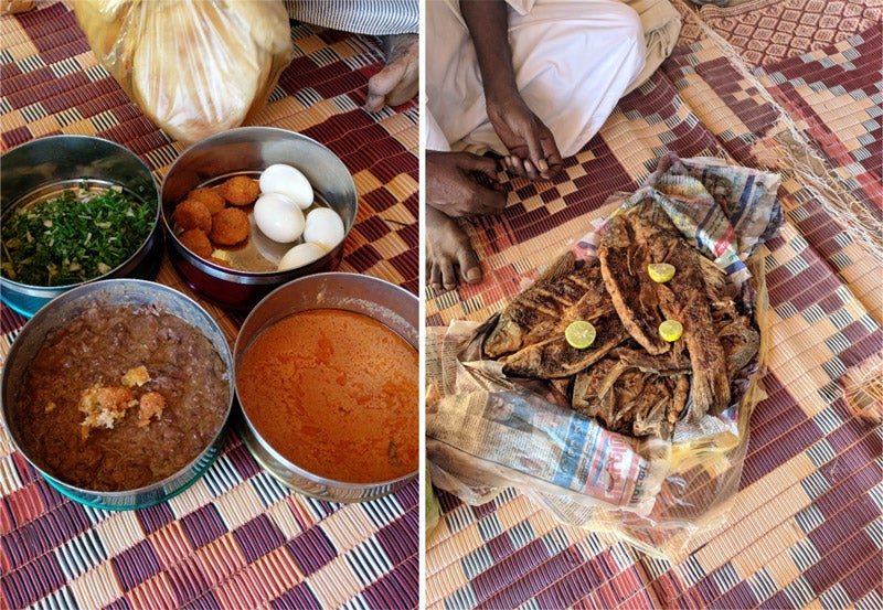
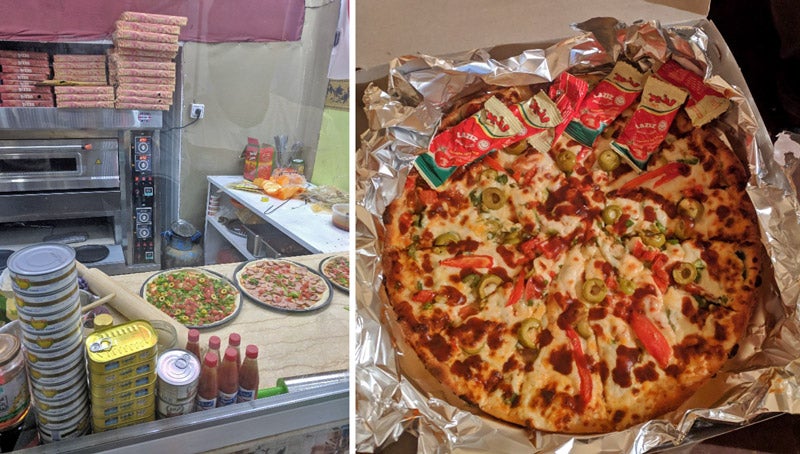
Part of the feeling of community comes from the fact that our meals are all communal. We share large dishes and eat with our hands, and the meals are always accompanied by bread. The main course is often fuul, a dish made of mashed beans with cheese or sardines or tomatoes or just about anything added to spice it up. We also often eat chicken, liver, a fish paste called fasikh, salad, and much more, and on special days we have fried fish! Last week, while staying the night in Karima, I even had pizza here for the first time, which I can highly recommend to the rest of the team coming next month!
Left: A typical fattur, with fuul, fasikh, tamia, eggs, and a few vegetables, to be shared between four to six people. Right: A special fish lunch.
Pizza making in progress (left), and our delicious dinner (right).
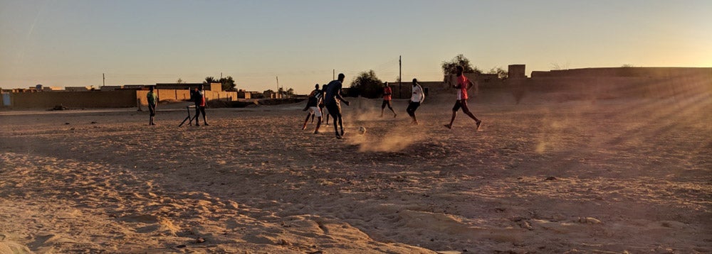
In past seasons after work I have played soccer with my friends here, in the shadow of the Kurru pyramids, but this year I have had to rest my legs and often opt to either watch the others play in the sunset or cool my feet in the Nile, which is only a five-minute walk from Sadiq’s.
The guys playing soccer at Kurru. The pyramid is just behind me as I take this photo.
Cooling my feet in the Nile.
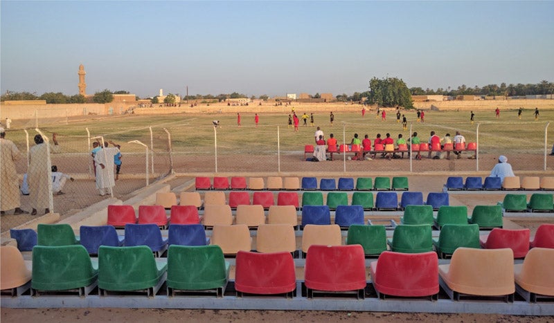
In past seasons we have even gone to see the Kurru soccer team play a few official matches, including big games against local rivals in the stadium at Karima. I’m in the field a bit earlier this year so the soccer season hasn’t started yet, but the first match is on Tuesday in Karima, and I’m looking forward to cheering on my friends from the stands after work!
A view from the stands at a soccer match in Karima (2017).
This year I’ve felt even more closely connected with life in the village, attending a few wedding celebrations and just last night an engagement party for Salah Mohamed, one of the guys who works with me at Jebel Barkal. We danced for hours (myself only sparingly) to traditional tambour music, and it seemed as if the whole village came to celebrate with Salah!
In addition to all these larger events, I spend many of my evenings with friends talking under the stars or watching Champions League or EPL soccer while drinking tea, which is ubiquitous here. This season I’ve even picked up a new game to play, Ludo, which is kind of like Trouble and brings out an intensely competitive nature among us! It might be worth checking out the next time you’re looking for an easy game to play with a few friends!
I have less than a week left for in the field, and it is going to go by far too quickly. Check back here next week for a final #fieldworkfriday update from Sudan for 2018!
Collecting magnetic data on our first day of survey at Jebel Barkal. Photo by Abdelbaki Salahadin Mohamend.
7 December 2018
By Gregory Tucker
This week for #fieldworkfriday I would like to share with you a bit of where I am and what I’m doing in the field. This month I’ve come to Sudan’s Northern State, to the site of Jebel Barkal, near the Fourth Cataract of the Nile, to conduct a geophysical survey in two distinct areas of the site.
Map of Sudan showing the location of Jebel Barkal.
Jebel Barkal is a small mountain not far from the Nile that was considered by the Egyptians and later the Kushites to be the home of the god Amun. Various temples, palaces, and pyramids were constructed at the site from the Egyptian New Kingdom (about 1500 BCE) to the end of the empire of Kush (about 300 CE), and these have been the targets of extensive excavation in modern times. Jebel Barkal and the nearby sites of El Kurru, Sanam, and Zuma are on the UNESCO World Heritage List.
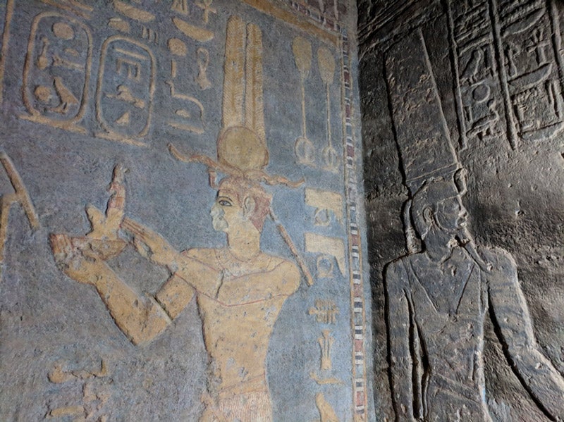
This image, which I took just yesterday, shows the amazing conservation work of the Italian-Sudanese team at the Mut Temple at Jebel Barkal. The image on the left has been cleaned and clearly shows Taharqa, while the image on the neighboring wall on the right is still covered in soot.
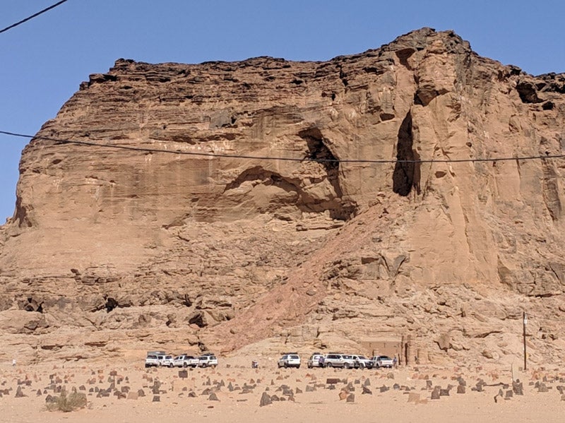
It’s tourism season in Sudan, as evidenced by the many vehicles bringing tourists to visit the site every day. Seeing this many together is rare, however, even this time of year!
Geophysical survey is one of the most efficient ways to explore a large landscape like that of Jebel Barkal in search of specific features that will help us understand how people lived in the past. The results of this month of survey will help our projects better understand and interpret the built environment of the site, shedding light on how the community at Jebel Barkal lived and how it relates to other sites and their architectural traditions from the region.
This past week we finished up our work for the first project, on the south side of the mountain, where we were working in the desert landscape near the pyramids at the site. We were invited to survey this area by Murtada Bushara Mohamed of Sudan’s National Corporation for Antiquities and Museums (NCAM) as part of the Qatari Mission for the Pyramids of Sudan (QMPS) project. This project is focused on research, preservation, and presentation of the pyramids at Jebel Barkal, Kurru, Meroe, and Nuri and our contribution will help us better understand the landscape context of these monuments by identifying the location of other structures in this region of Jebel Barkal.
The pyramids on the southern side of Jebel Barkal.
Tomorrow we will begin our work on the east side of the jebel, between the mountain and the Nile River, in an area we call the “East Mound.” This project is an offshoot of Geoff Emberling’s research at El Kurru and the surrounding region, and during preliminary research conducted in 2016 we identified this mound as being a likely location for the settlement associated with the temples and palaces of the monumental core of the site.[1] We were able to identify buried structures here during a very short period of survey that year, just a couple of days, so we have returned to survey the entire mound and the surrounding area to better define the extent of this settlement.
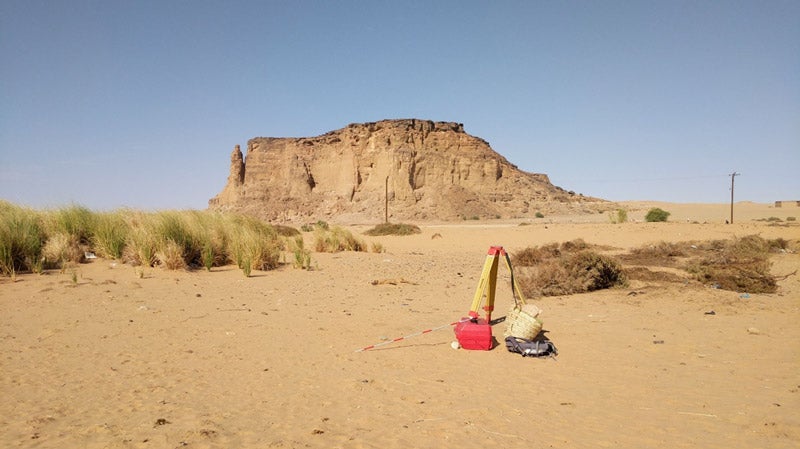
View toward Jebel Barkal from the “East Mound” as we begin to set up our equipment for the survey work in this area.
The type of prospection that I’m conducting can be done with many different instruments, each with its own unique method of collecting magnetic data. In the case of this project I am using a device that must be carried across the landscape and takes readings at consistent intervals.
The most efficient way to use this device is to set up a grid in the area that we wish to cover. Using a total station we establish a 30 x 30 m grid, and within that grid we lay down guidelines that are marked at every meter. Then, wearing the scientific device, I walk up and down along the guidelines, which are there to ensure that I walk straight and at a consistent pace.
By telling the instrument and the processing software the parameters of the survey, the data can be plotted quite quickly to create a map of the magnetic readings at the surface, giving us insight into what may lie buried below. With this particular machine we are limited only by how fast I can walk while maintaining a consistent pace and holding the machine relatively steady, which depends on the surface conditions — sand slows me down quite a lot! — and how well we have established the grid and the guidelines. Below is a short video that gives a first-person perspective of what walking one of these lines is like. (In a typical day I can walk approximately 540 lines!)
Of course, there is slightly more to it than just that, but the bulk of my time here is spent walking along these lines and listening to the machine chirp at me, 30 meters at a time.
I realize that I did not check the comments on my last post to see if there were any questions, but I will be better about that this week, so please comment with any questions you may have or email me at gstucker@umich.edu. I would love to hear from you! And please check in next week for another update from Sudan!
For the past several years, I’ve spent part of the winter in the small Sudanese village of El Kurru, and every year I fall a little bit more in love with it. I work there with Kelsey Research Scientist (and Kurru dig director) Geoff Emberling on the excavation and preservation of an ancient royal cemetery. Two years ago, the Kurru project team began to deliberately focus on community engagement as a way to forge stronger links between the local community and the ancient site.
This work has evolved slowly, beginning from plans to present the site to tourists (of which there are a surprisingly large number). El Kurru is an interesting site, with a big pyramid, two beautifully painted subterranean tombs, and a large rock-cut temple. But the site is only a small part of what I love about El Kurru. I love the Sudanese friends and colleagues we have there, the beauty of the Nile, and the family we live with. Tourists to the site, sadly, enter from a desert road and never have a reason to visit the town. As we planned the site itinerary for tourists, we kept saying to ourselves — wouldn’t it be great if visitors could keep walking and go into town, down through the date palm groves, and see the Nile? What if they could drink some Sudanese coffee, hear some music, and eat Sudanese food?
Over the past two years, we’ve worked with University of Michigan colleagues to assemble focus-groups in El Kurru to explore this idea. Not only did village residents think it was good idea — an exciting idea, even — to showcase local culture, they had a clear vision for what visitors should learn about their village and what experiences make El Kurru special. Here are photos of a few.
Mohammed Ahmed Al-Makee, who is in his nineties, is one of El Kurru’s last traditional weavers. His wife dyes and spins cotton into yarn, and from this he weaves scarves, shawls, and bed coverings on a pit-loom in the courtyard of his house. He allowed my colleague Jack Cheng and I to talk with him about his work and to record the sights and sounds of his loom, which he inherited from his grandfather.
Once or twice a during the field season, we are treated to a riverside concert of traditional music. There is singing and dancing, and the primary instrument is the tambour, a stringed guitar-like instrument. These instruments are made in the village and are often decorated by the town’s henna artist. In this group, the musician I know best is Abdel Bakee, the drummer.
Bread is the backbone of every meal in El Kurru. There are several popular kinds of bread in Sudan, but the one shown here is a pita-type bread made from wheat flour. It is baked fresh every day in multiple village bakeries and is especially delicious right out of the oven. The baker pictured here is Ahmed Ibrahim.
El Kurru is an agricultural village focused on date farming. The date palms grow in beautiful gardens along the Nile. Families own a plot of land and work together to irrigate it, care for the trees, and harvest the dates, of which there are many kinds. From the house where we live, we can walk across the street and through this section of trees to get to the Nile. It is about a five-minute walk to the river.
BY SEBASTIÁN ENCINA, Museum Collections Manager, Kelsey Museum of Archaeology
Though the summer months see a drop in university class visits to the Kelsey, the museum is by no means less busy when classes are not in session. Researchers who are students and professors here at Michigan, or at other universities around the world, take a break from their teaching responsibilities and make their way to the field and museums to continue their research. The Kelsey hosts a fair number of these scholars. Projects we did not have time for during the academic year are saved for the slower summer months.
As to be expected, the site of Karanis garners much attention from researchers. Every year we have numerous people come to study our collections on this Graeco-Roman site, or the archives that still contain a depth of information waiting to be revealed. This summer is no different, as Karanis has been the focus of an ongoing trial investigation by a group of Michigan scholars. Headed by Dr. Arthur Verhoogt (Classics) and Dr. David Stone (Kelsey Museum), a team has been assembled to determine what it would take to finally digitize, in a controlled and consistent manner, the entirety of Karanis holdings. This includes all the artifacts excavated at Karanis and brought to Michigan, but also all the maps, and archives, and photographs. Over the years, we’ve digitized some of the items, but only specific ones and only as requested.
This team, which also included graduate students Alexandra Creola (IPCAA), Caitlin Clerkin (IPCAA), and Lizzie Nabney (Classics), undergraduate students Emily Lime (Classics) and Mollie Fox (History of Art), professors Brendan Haug (Classics) and Laura Motta (Kelsey Museum), staff Sebastián Encina (Kelsey Museum) and Monica Tsuneishi (Papyrology), has decided to approach the site in a new manner. Previous research and publications have focused on material types. We have publications on the coins of Karanis, or the pottery, or papyrus. Instead, Drs. Stone and Verhoogt want to look at the context of the finds. How did the papyrus relate to coins found within the same space? What does a figurine found alongside a spindle whorl tell us about the inhabitants of house C56?
Over the past two months, students Mollie and Emily have been busy finding, cataloguing, and digitizing items from two contexts, C65 and C137. The team decided to focus on these two structures as they seemed of great interest due to their contents, and also because for a two-month trial project, looking at anything more would have been impossible. Mollie and Emily spent time going through the archives and identifying materials that related to these two structures (one house and one granary). They were then pulled, entered into a project-specific database, and eventually scanned or photographed. Among these was a 32-foot-long map that showed a cross section of Karanis which we are excited to finally have scanned!
The project was generously supported by the Michigan Humanities Collaboratory, an endeavor funded by the Office of the Provost that seeks to bring together people from separate departments to work together towards a single goal. Several projects were funded for this summer term, including this Kelsey-Classic-Papyrology project. We hope to turn this trial period into a much bigger one, where the entirety of Karanis materials are digitized and made available to researchers freely. By doing so, researchers can approach the materials in their own way, without hindrance. At the conclusion of the two year project, we will have a better understanding on what we have here in Ann Arbor, a web portal will be in place for ease of research, and there may be publications and an exhibition. While students continue to digitize and catalogue, graduate students and faculty will analyze the materials to make better sense of the spaces and what is possible with what we have on hand.
While it is easy to get excited about what the future will hold, there is equal buzz about what has been found already. Mollie and Emily have scanned the 32-foot map, which is amazing, but they have also found photographs and archival materials we have not seen since the 1930s. There has been closer inspection into the artifacts, what they tell us about the citizens of Karanis, and the decorations found on objects and on walls. A sample of these is shared here, so that we can look anew at a place we members of the Kelsey community know so well, yet we continue to find new ways to see it.
Archival Scans
Archival Scans
Scan of Pottery Sketch
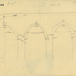
Section drawing
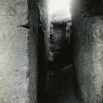
Excavation photo of objects in situ
Excavation photo of building
Artifact Photograph
Artifact Photograph
This summer has proven to be busy in the Kelsey Registry. This project has meant a steady stream of people in the office every day. Every computer is occupied, every free space taken up by archives or artifacts. But this busy-ness has generated an energy and excitement about what we can do with Karanis. There are endless possibilities, and we will keep busy this summer thinking about those and working to make them a reality.
BY SEBASTIÁN ENCINA, Museum Collections Manager, Kelsey Museum of Archaeology
Happy New Year, readers. The Kelsey Museum is back in the swing of business, and we are already in the midst of the semester, working with students, classes, and upcoming exhibitions. As it is the Winter term, some people begin planning for fieldwork and being overseas. Some Kelsey staff will be leaving for the field in just a matter of days, while others will wait until May/June/July to be at their respective projects.
For those who have never been on an archaeological dig, you are missing out! There is so much to learn, to experience. Being overseas, especially, affords a person the opportunity to interact with different people, eat different foods, and lead life at a different pace. There is also the opportunity to travel, see the sites a country has to offer. And there is, of course, the actual archaeology, what there is to discover that gives us a better understanding of the past. It truly is a magical experience.
But it’s not all fun and adventures. Sometimes being overseas brings with it some hindrances and annoyances that add up to interesting stories, but not exactly a great experience. For those not used to travel, new water and new foods will have an adverse effect on digestive system. Dealing with customs and authorities might be an issue. Many people will miss their family and friends, and the comforts of home.
In other cases, the environment is pestering, quite literally. Working as an archaeologist, one will find themselves outside often. Sun, wind, occasional rain, heat and cold all contribute to grueling days. And in many areas of the world, the flora and fauna of the region pose risks to health and work. Wild animals and overgrown plants get in the way, not caring for the work one is pursuing. Some, like the mosquito, will carry diseases one has to be wary of.
This is a problem that affects the modern archaeologist, but it is not a new dilemma. The papers of Qasr al-Hayr, an excavation headed by Oleg Grabar in the 1960s and 1970s, show how the simple fly was proving to be a nuisance even back then. Professor Grabar reached out to colleagues and experts for resources or suggestions for ways to handle the fly problem. In this month’s “From the Archives,” we see a response from a colleague at the Freer Gallery of Art, along with a pamphlet discussing the household fly from the US Department of Agriculture. The pamphlet makes recommendations, such as traps, screens, insecticides. However, the letter expands on this, noting that the region is rife with flies, and trying to tackle the situation would demand many more resources than realistically available, and any efforts would be lost as flies from surrounding regions would just fill the vacuum created.
Letter from Qasr al Hayr archives on fly problem in Syria
Pamphlet from the Qasr al-Hayr archives on the fly problem in Syria.
Qasr al-Hayr was a medieval Islamic town found between the Euphrates and Damascus. By its placement at the foot of one of the few mountain passes in the central Syrian desert, it commanded a commercial and strategic position of importance between settled and nomadic groups. Those of us who have worked in that area of the world know how prevalent flies are, and any efforts to lessen their numbers seem to be fruitless. They are a constant presence.
Being out in the field is truly a great experience, one many students, staff, and professors look forward to every year. But it comes with a price. Sometimes that price is large, other times it is small, but even those small problems have ways to multiply and cause big headaches.
BY SEBASTIÁN ENCINA, Museum Collections Manager, Kelsey Museum of Archaeology
Merry Christmas and Happy New Year from the Kelsey Museum of Archaeology. As is customary for the University of Michigan, staff at Michigan are given the week between Christmas and New Year’s day off. The Museum is preparing for this break, and the staff will shut down for behind-the-scenes business (don’t worry, the galleries will be open during the break). There is much work to do before we all go away, and much to get accomplished as we prepare for our upcoming exhibition, Leisure and Luxury in the Age of Nero: The Villas of Oplontis near Pompeii (opening February 2016). This is a frantic time of year, as we catch up on work and projects that were set aside while working with students and classes.
Our predecessors worked hard during this time of year as well. Egypt is an extremely hot country, so the traditional dig season for many archaeologists, North American summer (when classes are no longer in session), is not ideal for excavations there. The extreme heat found in the deserts would be dangerous for the crew members on any dig. Instead, the Michigan team, as do many other projects then and now, opt for a North American winter season. Teams would arrive in Autumn, and due to the long trip to Egypt, they would stay a prolonged period of time. In many cases, the teams would be in Egypt over the holiday break, working from December (or earlier) into the new year and beyond. For the Karanis team, this meant being in Egypt, away from family, on Christmas. But they made the most of it. Pictures show decorations at the dig house as the team made their surroundings festive.
They, and the rest of the team, found other ways to keep entertained during the holiday season. And that is the focus of this month’s From the Archives. While at Karanis, the workers held a fencing contest on Christmas day (KM Neg #676). Unfortunately, our records do not indicate what year this took place, or if this happened every year, but we know that at least once in the life of the excavation, some fun was had with a fencing competition. The archives do not indicate if there was a winner, how many participated, or if this was just a random occurrence between two people having a little fun. The photographer is also unknown, though it would not be a stretch to assume George R. Swain was the man behind the camera.
Workmen fencing on Christmas Day. KM Neg #676.
On a Christmas day 90 years ago, the Karanis project team was preparing for their own holiday season just as we are today. They had decorations and games to pass the time. They were finding ways to make their current home as festive and comfortable as their permanent homes. Thousands of miles from Michigan, they just wanted the same comforts we will be enjoying soon.