Jebel Barkal: The jebel (mountain) in the background with the Amun Temple (B 500) in the foreground.
2019 drone photo by Kate Rose.
This Wednesday, Kelsey Museum Associate Research Scientist Geoff Emberling will give a lecture about current archaeological work at the site of Jebel Barkal (ancient Napata) in northern Sudan. The site is being investigated as a joint project of the National Corporation for Antiquities and Museums of Sudan and the University of Michigan.
The lecture, “Collaborative Archaeology of Kush in Northern Sudan: Recent Work around Jebel Barkal,” will present the results of the project’s first seasons of work on Meroitic levels of settlement at the site, contemporary with the Roman occupation of Egypt (1st century BCE–1st century CE). Dr. Emberling will also discuss how the long histories of colonialism and structural racism have distorted our understanding of the ancient cultures of Africa and diminished their contributions to world history.
Visit Stanford University’s Archaeology Center website for more information and to register to attend this free lecture, which will be live-streamed from Stanford University on Wednesday, May 4, at 3:00 PM ET.
Campus is hopping with students and faculty here in A2, and I have to say—it’s pretty fun. Our Wolverine community is doing great on vaccinations and masking, and the energy from having everyone back together is inspiring. Meanwhile, here in the conservation lab, lots of projects are either continuing or just getting started.
A new(ish) project I’m especially excited about is the Kelsey’s Jebel Barkal Archaeological Project, which is gearing up for a 2022 winter field season in Sudan after being grounded during 2021. We have several generous sponsors for this work, including the Bureau of Educational and Cultural Affairs at the U.S. Department of State, which will be funding conservation work at the site through a large Ambassador’s Fund for Cultural Preservation grant. If you’d like to learn more, please visit our brand new website, which I and several of my colleagues have been developing over the past month. I encourage you to sign up for the Jebel Barkal blog and stay tuned, since we’re working on adding other social media.
If you’re a regular reader of this blog, you’ll know that we luuuuv fall around here. Luckily for us, it’s the autumnal equinox and the weather has turned right on schedule—from 80 degrees and sunny to 60 degrees and raining like crazy. We’re putting on sweaters and re-reading Colin Nissan’s McSweeney’s essay on decorative gourds. I’m not going to link it, because the language is too fruity for a family-friendly blog, but if you already know and love it, now is officially the time to get reacquainted.
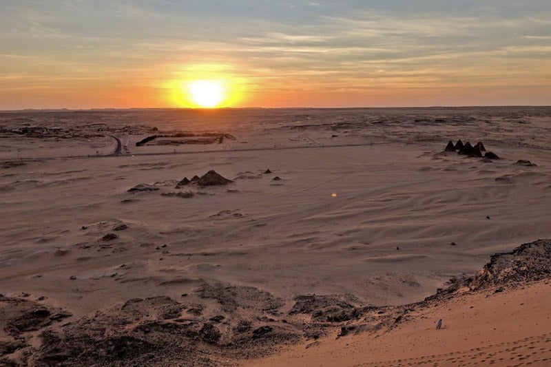
Sun setting across the desert landscape from the top of Jebel Barkal, with the pyramids in the midground.
15 February 2019
By Gregory Tucker
I was hoping to submit this last blog post on my time in Sudan, sharing some of our results, as I left the country on 21 December 2018, but unfortunately some rather significant events occurred and I had to leave the country early. On the 19th and 20th of December, protests erupted across the country with various motives that I will not focus on in this post, but I encourage you to read up about these events here and here. I was on my way to Khartoum during this period and while there I was advised to stay in the hotel and to leave the country on the earliest flight possible. In the end, I had no trouble at all leaving Sudan and saw no signs of the protests or their aftermath on the streets from the hotel to the airport, and I was very glad to arrive safely back home to news from my Sudanese friends and colleagues that they were all safe and in good health. Since I left, other research projects have continued to visit Sudan, such as the Uronarti Regional Archaeology Project, although the protests have continued off and on. These protests have recently resumed after a period of relative calm and I hope that the Michigan team now in Sudan stays safe and out of trouble!
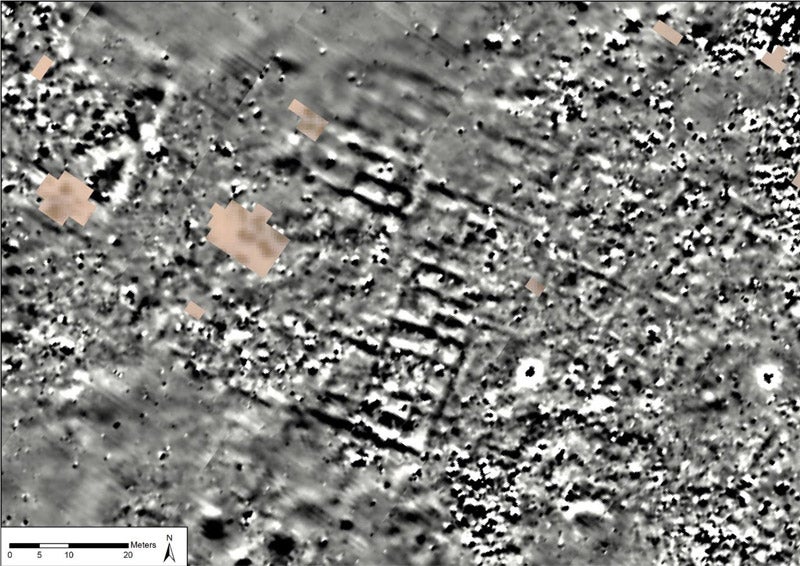
The results of our survey work in December 2018 as part of the University of Michigan-led project!
In the image above, you can see the results of this season of geophysical survey and how it relates to the large Temple of Amun, visible in the left center of the image, and to the palm line to the lower right. This season of geophysics at Jebel Barkal was successful in defining a large number of archaeological features of interest, some of which are being investigated more intensively right now by other members of the project team on site. One of these is shown in more detail in the figure below, which zooms in on the center of the larger area of gray results in the larger image. What is most significant are the straight lines and right angles formed by the lighter and darker pixels, which reflect differing magnetic readings across the surface.
Results from the center of the survey area, showing rectilinear anomalies that likely define a buried structure, not visible on the surface.
More detailed results and analysis of this survey season will be published after thorough analysis, interpretation, and comparison with the excavation results. It was a fantastic field season, even with the hot weather at the beginning and the other obstacles we encountered. At times I didn’t think that we would complete everything we set out to do, but in the end we did even more than we targeted — a rare event in my experience!
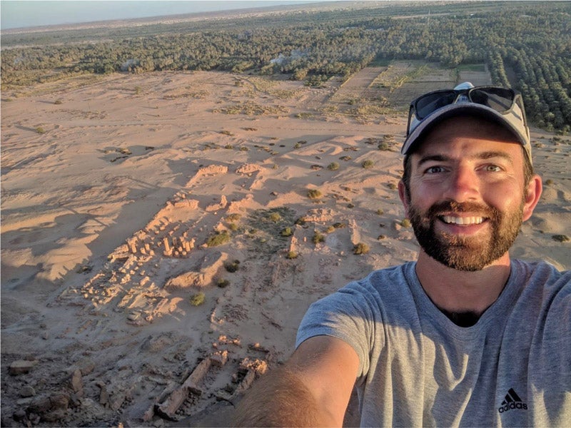
A final selfie over the site from the top of Jebel Barkal, including the Temple of Amun in the foreground and the main survey area in the near distance to the upper left of the image.
Many thanks are due to the many people who made this fieldwork possible. First of all, I want to thank my assistants in the field, Bakri Abdelmonim and Abdelbaqi Salaheddin Mohamend, who I have worked with now for many years and whose experience and expertise make my job significantly easier. Thanks also to Sami Elamin, our NCAM (National Corporation for Antiquities and Museums of Sudan) inspector, who helped me to organize work on site as well as my day-to-day life while in Sudan, and who invited me to many social events in El Kurru and nearby towns and cities, including me as much as possible in the life of the region. Many thanks to everyone in El Kurru who welcomed me during the month of fieldwork and have always welcomed me — it feels like a home away from home when I am there. I would like to also thank our project’s overall director, Geoff Emberling (University of Michigan), for supporting my work from the very start. Hopefully we’ll make many more discoveries together. Finally, the greatest of thanks are due to Larry and Julie Bernstein for the financial support that made this work possible, we could not have done it without your generosity.
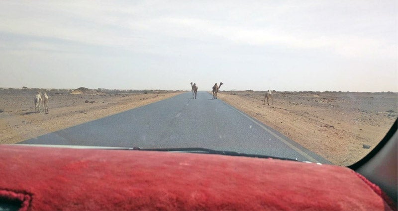
Camels on the highway on the trip back to Khartoum.
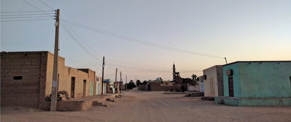
The main street in Kurru in the early morning hours before work. Waleed’s shop, where we buy snacks and supplies but most importantly bottled water, is on the left less than 100 meters from our front door, and the barber shop, painted green, is right across the street!
14 December 2018
By Gregory Tucker
The past week has been incredibly busy as we try to prepare the site for the final days of data collection before I leave for Khartoum next Thursday. In next week’s post I will share some of the initial results of all of our hard work here, but this week I will focus on what my life is like in Sudan outside of work.
The International Kurru Archaeological Project stays in the village of El Kurru, near the ancient site, and we are kindly hosted by Sadiq Mohamed Saleh and his family. This month I have been staying in Kurru rather than closer to Jebel Barkal, as it is only a 15–20 minute car ride to the site. It is also where all of my friends from past field seasons live, and where I feel welcomed as a part of the community.
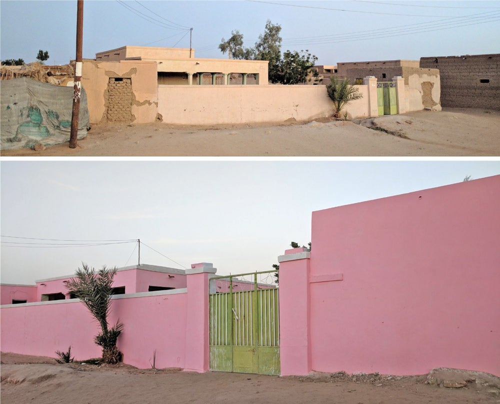
The front entrance to Sadeq’s house, before (top, 2017) and after (below, 2018) its new paint job!
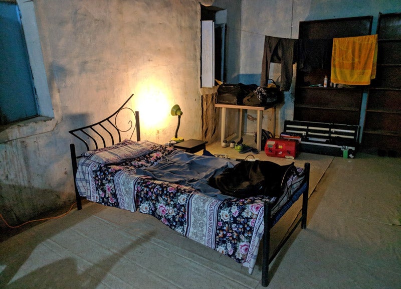
My bed (taken the first week of the project — I assure you it is nowhere near this tidy anymore) with equipment charging and my personal effects in the corner.
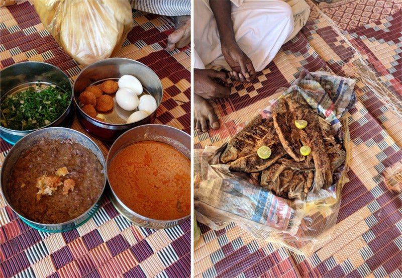
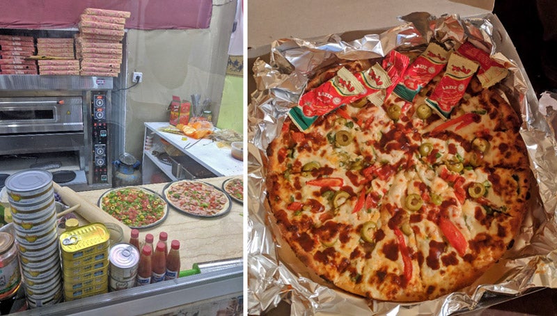
Part of the feeling of community comes from the fact that our meals are all communal. We share large dishes and eat with our hands, and the meals are always accompanied by bread. The main course is often fuul, a dish made of mashed beans with cheese or sardines or tomatoes or just about anything added to spice it up. We also often eat chicken, liver, a fish paste called fasikh, salad, and much more, and on special days we have fried fish! Last week, while staying the night in Karima, I even had pizza here for the first time, which I can highly recommend to the rest of the team coming next month!
Left: A typical fattur, with fuul, fasikh, tamia, eggs, and a few vegetables, to be shared between four to six people. Right: A special fish lunch.
Pizza making in progress (left), and our delicious dinner (right).
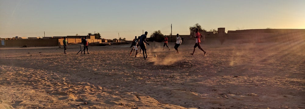
In past seasons after work I have played soccer with my friends here, in the shadow of the Kurru pyramids, but this year I have had to rest my legs and often opt to either watch the others play in the sunset or cool my feet in the Nile, which is only a five-minute walk from Sadiq’s.
The guys playing soccer at Kurru. The pyramid is just behind me as I take this photo.
Cooling my feet in the Nile.
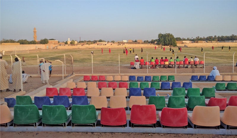
In past seasons we have even gone to see the Kurru soccer team play a few official matches, including big games against local rivals in the stadium at Karima. I’m in the field a bit earlier this year so the soccer season hasn’t started yet, but the first match is on Tuesday in Karima, and I’m looking forward to cheering on my friends from the stands after work!
A view from the stands at a soccer match in Karima (2017).
This year I’ve felt even more closely connected with life in the village, attending a few wedding celebrations and just last night an engagement party for Salah Mohamed, one of the guys who works with me at Jebel Barkal. We danced for hours (myself only sparingly) to traditional tambour music, and it seemed as if the whole village came to celebrate with Salah!
In addition to all these larger events, I spend many of my evenings with friends talking under the stars or watching Champions League or EPL soccer while drinking tea, which is ubiquitous here. This season I’ve even picked up a new game to play, Ludo, which is kind of like Trouble and brings out an intensely competitive nature among us! It might be worth checking out the next time you’re looking for an easy game to play with a few friends!
I have less than a week left for in the field, and it is going to go by far too quickly. Check back here next week for a final #fieldworkfriday update from Sudan for 2018!
Collecting magnetic data on our first day of survey at Jebel Barkal. Photo by Abdelbaki Salahadin Mohamend.
7 December 2018
By Gregory Tucker
This week for #fieldworkfriday I would like to share with you a bit of where I am and what I’m doing in the field. This month I’ve come to Sudan’s Northern State, to the site of Jebel Barkal, near the Fourth Cataract of the Nile, to conduct a geophysical survey in two distinct areas of the site.
Map of Sudan showing the location of Jebel Barkal.
Jebel Barkal is a small mountain not far from the Nile that was considered by the Egyptians and later the Kushites to be the home of the god Amun. Various temples, palaces, and pyramids were constructed at the site from the Egyptian New Kingdom (about 1500 BCE) to the end of the empire of Kush (about 300 CE), and these have been the targets of extensive excavation in modern times. Jebel Barkal and the nearby sites of El Kurru, Sanam, and Zuma are on the UNESCO World Heritage List.
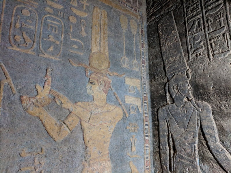
This image, which I took just yesterday, shows the amazing conservation work of the Italian-Sudanese team at the Mut Temple at Jebel Barkal. The image on the left has been cleaned and clearly shows Taharqa, while the image on the neighboring wall on the right is still covered in soot.
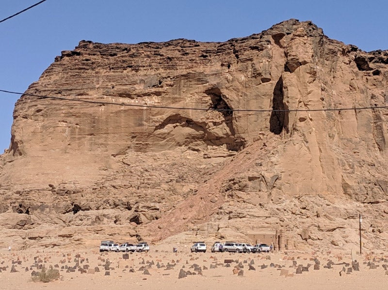
It’s tourism season in Sudan, as evidenced by the many vehicles bringing tourists to visit the site every day. Seeing this many together is rare, however, even this time of year!
Geophysical survey is one of the most efficient ways to explore a large landscape like that of Jebel Barkal in search of specific features that will help us understand how people lived in the past. The results of this month of survey will help our projects better understand and interpret the built environment of the site, shedding light on how the community at Jebel Barkal lived and how it relates to other sites and their architectural traditions from the region.
This past week we finished up our work for the first project, on the south side of the mountain, where we were working in the desert landscape near the pyramids at the site. We were invited to survey this area by Murtada Bushara Mohamed of Sudan’s National Corporation for Antiquities and Museums (NCAM) as part of the Qatari Mission for the Pyramids of Sudan (QMPS) project. This project is focused on research, preservation, and presentation of the pyramids at Jebel Barkal, Kurru, Meroe, and Nuri and our contribution will help us better understand the landscape context of these monuments by identifying the location of other structures in this region of Jebel Barkal.
The pyramids on the southern side of Jebel Barkal.
Tomorrow we will begin our work on the east side of the jebel, between the mountain and the Nile River, in an area we call the “East Mound.” This project is an offshoot of Geoff Emberling’s research at El Kurru and the surrounding region, and during preliminary research conducted in 2016 we identified this mound as being a likely location for the settlement associated with the temples and palaces of the monumental core of the site.[1] We were able to identify buried structures here during a very short period of survey that year, just a couple of days, so we have returned to survey the entire mound and the surrounding area to better define the extent of this settlement.
View toward Jebel Barkal from the “East Mound” as we begin to set up our equipment for the survey work in this area.
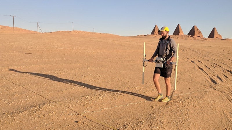
The type of prospection that I’m conducting can be done with many different instruments, each with its own unique method of collecting magnetic data. In the case of this project I am using a device that must be carried across the landscape and takes readings at consistent intervals.
The most efficient way to use this device is to set up a grid in the area that we wish to cover. Using a total station we establish a 30 x 30 m grid, and within that grid we lay down guidelines that are marked at every meter. Then, wearing the scientific device, I walk up and down along the guidelines, which are there to ensure that I walk straight and at a consistent pace.
By telling the instrument and the processing software the parameters of the survey, the data can be plotted quite quickly to create a map of the magnetic readings at the surface, giving us insight into what may lie buried below. With this particular machine we are limited only by how fast I can walk while maintaining a consistent pace and holding the machine relatively steady, which depends on the surface conditions — sand slows me down quite a lot! — and how well we have established the grid and the guidelines. Below is a short video that gives a first-person perspective of what walking one of these lines is like. (In a typical day I can walk approximately 540 lines!)
Of course, there is slightly more to it than just that, but the bulk of my time here is spent walking along these lines and listening to the machine chirp at me, 30 meters at a time.
I realize that I did not check the comments on my last post to see if there were any questions, but I will be better about that this week, so please comment with any questions you may have or email me at gstucker@umich.edu. I would love to hear from you! And please check in next week for another update from Sudan!